Start with the exact river entry: swimming must be permitted, access must be open for your visit, and any admission fee, parking charge or advance booking must be checked. A seasonal gate, closed path or swimming ban can rule out a place even when the river itself is publicly accessible.
The useful search is not simply for the nearest river. It is for a permitted entry with a workable exit, relevant official water-quality information and conditions you can assess. A pin on a map is not permission to swim.
Category: Near you. This is a planning guide, not a live list of open swimming spots. It provides no individual-site opening notice or dated water-quality result; those checks need to be made for your chosen entry before each visit.
Find the river entry, not just the river
Maps help locate candidates, but the important detail is the route between the public road and the water. A riverbank may be public while the shortest path to it crosses a private drive, railway land or a restricted section of a park.
- Search around a named place. Combine your town, county, state or postcode with terms such as “river swimming” or “public river swimming area”. Search around the park entrance or access point, rather than relying on the river’s map label.
- Identify the land manager. Find the park, council, recreation-area operator or landowner responsible for that bank. In the United States, this may be a municipal or county parks department, state park, National Park Service, U.S. Forest Service or Bureau of Land Management office.
- Trace the complete route. Establish the parking location, entrance, public path, gates and final approach to the water. Note the walk distance, surface and any steps or steep banks, especially when travelling with children or someone with limited mobility.
- Locate an exit before committing to the trip. The intended exit must also be accessible and permitted. Do not plan around scrambling onto a private bank or crossing a stronger channel to get out.
Google Maps, Apple Maps, OpenStreetMap, trail apps and swimming directories can help with discovery. Visitor photographs and reviews cannot establish permission, current opening status or water quality.
Check permission, opening status and costs separately
Legal access to land and permission to swim are different checks. A public footpath may allow passage beside a river without granting access down the bank. Public ownership of a park does not remove swimming restrictions within it.
| Location | Access rule to check |
|---|---|
| United States | Use the responsible land manager’s rules for the exact reach. National Park Service land remains subject to park closures, swimming restrictions and designated-use rules. |
| England | The Countryside and Rights of Way Act 2000 does not create a general right to swim in rivers. Establish permission for the entry and the route through the landowner, operator or local access authority. |
| Wales | Check the specific path, riverbank and swimming permission with the landowner or responsible authority. Follow local restrictions; countryside access is not blanket permission to enter any river. |
| Scotland | The Land Reform (Scotland) Act 2003 provides responsible non-motorised access to most land and inland water, subject to exclusions and restrictions. Follow the Scottish Outdoor Access Code. |
For your chosen entry, record open only when both the approach and water entry are permitted for your visit. Record seasonal where access depends on defined opening dates, and write down those dates. Keep lifeguard hours separate: an accessible bank is not necessarily supervised.
Book ahead applies where entry, parking or a permit requires a reservation. Check admission and parking charges separately, including the currency and any gate-closing time. Do not describe a spot as free simply because the path has no ticket booth.
A closure, swimming ban or official instruction to avoid the water takes priority over an older listing. An informal path around a barrier is not an alternative entrance.
Read the official water-quality information correctly
Look for information about the same swimming reach, not just the same river. A monitoring point upstream of a sewage outfall, tributary or town may not describe conditions at your entry.
| Region | Official information to check | Coverage limit |
|---|---|---|
| United States | State, county, municipal or park-agency recreational-water results and health advisories. | The EPA beach programme covers coastal and Great Lakes recreational beaches, not every inland river. Inland monitoring varies locally. |
| England | Environment Agency Swimfo profiles, classifications, sample information and pollution-risk advice for designated bathing waters. | Most informal river entries are not designated bathing waters and do not receive routine statutory bathing-water classification. |
| Wales | Natural Resources Wales designated bathing-water information and pollution-risk advice. | An undesignated river entry may have no comparable routine bathing-water classification. |
| Scotland | Scottish Environment Protection Agency bathing-water information and pollution-risk forecasts for designated sites. | A nearby designated site does not automatically cover an informal river entry. |
In England, the annual classifications are Excellent, Good, Sufficient and Poor. They describe microbiological quality using samples collected during bathing seasons. They are not a same-day clearance, and designation does not mean lifeguards are present.
For a published sample, record the agency, monitoring location, sample date, parameter, result and units, together with the agency’s advisory threshold or interpretation. Also check for a newer warning. The date a page was updated is not necessarily the date the water was sampled.
- No dated result at the entry: write “No official dated water-quality result found for this entry”, followed by the date you checked. Missing data does not mean clean water.
- A result from another reach: identify that limitation rather than transferring its rating to your entry.
- An older favourable result: check for subsequent rain, sewage incidents and health advisories. A laboratory sample describes a particular place and time.
- Clear-looking water: do not treat visibility, colour or popularity as evidence of microbiological quality.
Water-quality information also does not assess current strength, cold shock, submerged obstacles or the difficulty of getting out. Those need a separate check.
Check upstream rain, river levels and flow
Dry weather at the riverbank does not rule out rising water. Rain elsewhere in the catchment can arrive later, bringing stronger flow, debris and pollution. Check upstream conditions as well as the forecast at your destination.
- Read flood and weather warnings. In the United States, use National Weather Service warnings alongside local park alerts. In the UK, check the relevant official flood-warning and river-level service.
- Choose a relevant gauge. The USGS National Water Dashboard provides streamflow and gauge-height information for U.S. monitoring stations. Environment Agency river-level information serves monitored locations in England. Match the station to your reach and catchment, not simply the shortest map distance.
- Read the timestamp and trend. A rising level means conditions are changing. A falling level does not make a river suitable for swimming if flow remains high, debris is moving or pollution advice remains in force.
- Check local rainfall and pollution advice. Follow the authority’s warning period for that site. Do not substitute a blanket 24-, 48- or 72-hour waiting rule.
Discharge is usually reported in cubic feet per second in the United States and cubic metres per second in the UK. It measures the volume passing a point, not the current speed at your entry. There is no universal discharge or water-depth threshold that makes every river suitable for swimming.
Heavy rain is both a flow warning and a pollution warning. It can wash livestock waste and road runoff into rivers and trigger discharges from combined sewer systems. Water levels and bacterial contamination do not necessarily recover on the same timetable.
Inspect the entry, exit and downstream hazards
Once there, assess the reach from the bank before changing or entering. A calm-looking pool may drain directly towards a weir, culvert or fallen tree. Being a strong pool swimmer does not remove those hazards.
- Read the latest signs. Check the entrance and water’s edge for closures, pollution warnings, release notices and no-swimming rules.
- Watch the water for several minutes. Leave if it is rising, carrying branches, becoming discoloured or changing visibly. Unexpected foam, visible algal scum or an official cyanobacteria warning is a reason to stay out.
- Inspect your exit from land. Choose stable footing that does not depend on climbing a muddy vertical bank. Identify a permitted downstream backup exit without planning a swim that relies on drifting to it.
- Check where the current leads. Stay out where it carries towards fallen trees, fencing, bridge openings, culverts or other obstructions. Avoid weirs and low-head dams, including apparently smooth water above them.
- Enter slowly, feet first, only if the checks support entering. Do not jump or dive into unfamiliar water. If the current makes standing or reaching the exit uncertain, do not continue.
Outside bends, narrow channels and gaps between rocks can concentrate flow. Eroded, undercut banks may conceal cavities. Fallen trees and fences can act as strainers: water passes through while a swimmer becomes trapped. Walking in moving water also brings foot-entrapment risk, where a foot wedges between rocks and the current pushes the body downstream.
Warm air does not mean warm water. Groundwater, snowmelt, shade and reservoir releases can keep rivers cold in summer. Gradual entry helps you respond to the temperature; if breathing becomes uncontrolled, get out rather than pushing on.
Resolve missing information without guessing
- The map shows an entry but the route reaches private land: use the manager’s published public entrance. If no authorised route is available, choose another site rather than following a worn path.
- The park is open but swimming rules are missing: establish the rule for that reach with the operator before travelling. General park access is not enough.
- The nearest gauge is on another tributary or beyond a major confluence: look for a better-matched station or local advice. Do not translate the reading into a swimming decision for a different channel.
- No official water-quality result is available: consider a managed or designated site with relevant monitoring instead. Appearance and visitor reviews cannot fill the data gap.
- The exit is blocked or conditions differ from the description: abandon the swim. An improvised crossing or downstream drift is not a substitute for a planned exit.
Prepare for cold water and an emergency
Use a competent companion and tell someone on land the river name, exact entry, planned exit and expected return. Carry a reliable way to raise the alarm, and save the access details before leaving mobile coverage.
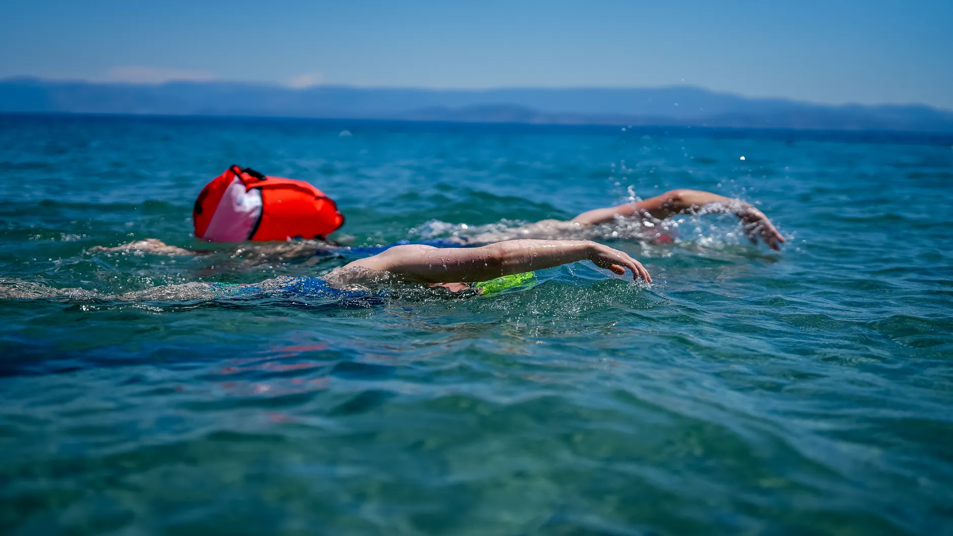
- Visibility and flotation: bright swimwear and a tow float can help others see you. A tow float is not a lifejacket. A properly fitted buoyancy aid does not make strong current or a weir suitable for swimming.
- Children: keep them within reach around moving water. Shallow margins can contain abrupt holes or stronger current a step away.
- Health: cover cuts, avoid swallowing river water and wash afterwards. Seek medical advice if you become ill after freshwater exposure, and mention the swim.
- Impairment: do not swim after drinking alcohol or using drugs.
- Rescue: call 911 in the United States or 999 in the UK. Give the river name, access point, nearby landmark and downstream direction. Do not enter the current to rescue someone; use a reach-or-throw aid from a secure position where possible.
Keep a dated record for your chosen spot
Save the access permission, opening status, fees and booking details with the responsible authority’s name and the date checked. Record water-quality sample dates separately from the date you viewed them, and retain the relevant gauge timestamp and warning information. These details can change independently.
Choose the entry, not just the river: permitted access, an open route, relevant official water-quality information and a usable exit all matter. Swimming outdoors is at your own risk; check current closures, pollution advice, upstream weather and river conditions again before getting in.