Creek swimming is only an option where access is legal and swimming is permitted. Before travelling, check whether the site is open, seasonal, book ahead, or closed or swimming banned. Public land can still have swimming restrictions, parking charges, entry fees or reservation requirements.
A map pin is not permission to swim. It might mark a bridge, private riverbank, waterfall viewpoint or flood channel rather than a usable swimming area. This guide explains how to choose a creek swimming hole; it is not a live opening-status or water-quality report for an individual spot.
Our starting point is access, then water conditions, then the pool itself. A deep, clear pool is not worth considering if reaching it requires trespassing, its only exit is unreliable or heavy rain is moving through the catchment upstream.
Find permitted access before choosing a pool
When looking for creek swimming near you, use maps to locate possibilities and the managing authority’s rules to decide whether they belong on your shortlist. A public road beside a creek does not automatically provide access across the bank.
- Identify the exact creek, pool and land manager. Search the place name with “park swimming rules” or “official swimming access.” Look for a national park, state or local park, public-land agency, or landowner that welcomes visitors.
- Check permission for swimming, not just walking. An open trail or picnic area can lead to water where swimming is prohibited. Read the rules for the specific waterbody and access point.
- Trace the permitted route to the water. Use the authority’s map to locate parking, the trailhead, boundaries and the swimming area. Reject routes that require crossing fences, locked gates, private gardens or restricted land.
- Check the practical limits. Record gate hours, season dates, parking rules, entry charges and any reservation or permit requirement. Check notices again immediately before leaving.
In the United States, access varies by state, land manager and local property rules. In England, permission to use a path or access land does not automatically include swimming. Scotland’s access rights operate under the Scottish Outdoor Access Code and do not remove local restrictions. There is no single access rule that covers every creek.
Read the status carefully: open does not mean suitable today
Access status and water conditions answer different questions. A park can be open while its creek has a pollution advisory, dangerous flow or a swimming ban. A water-quality result also says nothing about whether the route across the bank is legal.
| Status | What it means | What to check before travelling |
|---|---|---|
| Open | The authority permits access and swimming, with no active closure or swimming ban. | Hours, fees, later notices, water-quality advisories and same-day weather. |
| Seasonal | Access or swimming is permitted only during specified periods or conditions. | Exact dates, gate hours and any water-level restrictions. |
| Book ahead | A reservation, timed ticket, permit or capacity-controlled booking is required. | Availability, arrival window, charges and cancellation rules. |
| Closed or swimming banned | Entry, swimming or both are prohibited. | Choose another permitted location. An open footpath does not override the restriction. |
A useful listing names the authority and gives an exact last-checked date, not simply “recently updated.” Where a notice has its own publication date, retain that too. A later closure, flood warning or health advisory takes precedence over an earlier open status.
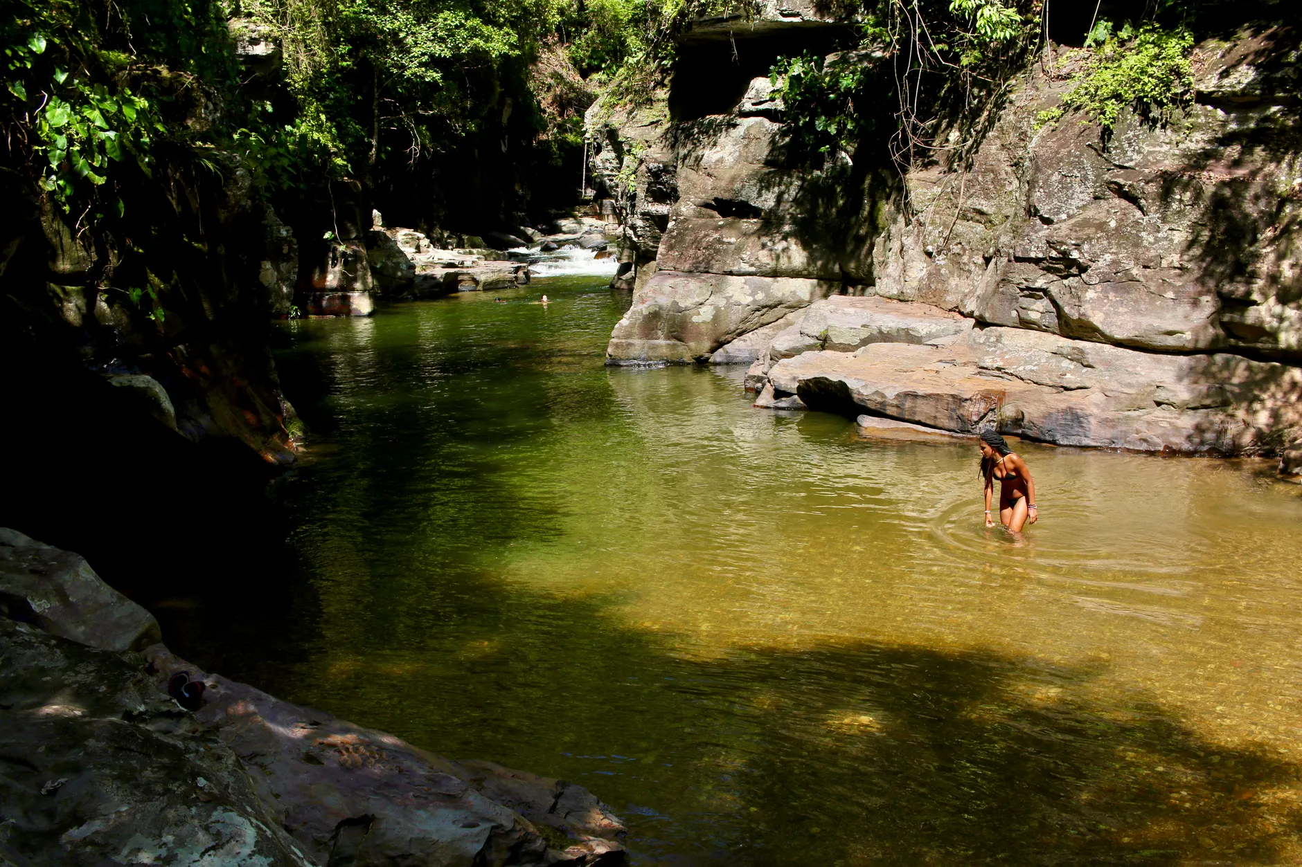
What makes the pool itself suitable?
A good candidate has enough depth for the intended activity, a stable way in and out, and no evident dangerous current or entrapment hazard. The National Park Service identifies submerged rocks, strainers, cold water, strong currents and sudden depth changes among the hazards in natural water.
- Depth that matches the swimmer. A wading area is not necessarily a swimming area. A pool can be shallow beside the bank and drop suddenly in the centre. There is no universal creek depth that makes swimming safe.
- A visible, assessable bottom. Clear water helps reveal rocks, branches and changes in depth. Reflections and water colour can be misleading, and visibility does not prove the absence of hazards.
- Slow water away from constrictions. Avoid rapids, narrow channels, bridge piers, culverts and the approaches to drops. A calm surface can conceal stronger flow below.
- A reliable exit. Look for a designated beach, firm bank, stable steps or another permitted route out. A steep muddy slope, undercut edge or slippery rock face is not a dependable exit.
- Stable banks. Fresh cracks, loose rock, collapsing edges and erosion after rain are reasons to choose another place.
- No strainers. Fallen trees, fencing, root masses and other debris can let water through while trapping a swimmer. Do not enter a pool where the current could carry you into them.
Assess what you can from the permitted bank first. If you cannot judge the current, footing or exit, choose a managed swimming area rather than entering to investigate. RoSPA’s open-water guidance likewise emphasises checking depth, currents, underwater obstacles, water quality and escape routes.
Exclude pools below dams, weirs and artificial drops. Recirculating water can hold someone underwater even where the drop looks small. Waterfall pools also need particular caution: the visible plunge pool does not reveal submerged ledges or the full flow pattern.
Never dive into unknown creek water. A rope swing, jumping rock or previous visit does not establish today’s depth or show whether a storm has moved branches, rocks or sediment into the landing area.
Check official water quality — not just clarity
Clear water can contain pathogens. The Centers for Disease Control and Prevention warns that contaminated recreational water can look clean, so appearance cannot replace an official result or advisory check.
In the United States, the EPA Beach Program does not provide testing for every inland creek. Check the relevant state, tribal or local health authority and the park manager for monitoring results and incident notices. In England, the Environment Agency’s bathing-water programme applies to designated bathing waters; a nearby designated site’s result does not describe an unmonitored creek.
- Match the monitoring point to the swimming area. An upstream or downstream sample is not automatically representative of the pool.
- Read the result with its date. Look for the sample date, named agency, measured parameter or classification, and any accompanying advisory.
- Distinguish a classification from a current sample. England’s classifications — Excellent, Good, Sufficient and Poor — are not a same-day guarantee.
- Check for newer notices. A sewage release, harmful algal bloom or chemical incident can make an older result irrelevant to today’s decision.
If official records contain no dated result for the exact swimming area, the listing should say “No official testing found” and include the date of that check. That is a testing gap, not evidence of clean water. If official monitoring is important to your choice, look for a designated bathing area with dated results rather than treating an untested creek as equivalent.
Stay out where there is an active advisory, visible algal scum, unusual discolouration, a strong unusual odour or dead fish. The CDC advises keeping people and pets away from suspected harmful algal blooms. Report concerning conditions to the land manager or environmental regulator.
Check upstream weather and flash-flood risk
Blue sky over the pool does not mean the creek will stay low. Rain upstream can reach a swimming hole with little warning, particularly in steep catchments, narrow gorges and channels with few exits.
- Check the upstream catchment forecast. Do not limit the search to the nearest town. Look for heavy rain and thunderstorms in the area that drains into the creek.
- Read flood alerts before setting out. In the United States, a National Weather Service Flash Flood Watch means conditions favour flash flooding. A Flash Flood Warning means flooding is occurring, imminent or reported.
- Leave immediately during a Flash Flood Warning. Move to higher ground without waiting to see the water rise. Do not cross the creek to reach safety.
- Keep watching conditions. Rising or darkening water, floating debris, increasing flow or a new rumbling sound are reasons to get out and move away from the channel.
In the United Kingdom, check Met Office rain and thunderstorm warnings alongside the relevant national flood-alert and river-level services. Avoid creek swimming during storms and after intense rainfall in the catchment. There is no universal waiting period after rain: drainage, sewage infrastructure, ground saturation and channel shape differ between sites.
Do not wait beneath a bridge, beside a culvert or under an overhanging bank during a storm. Leave while the permitted route is still usable; rising water can cut off an exit before the pool itself looks dramatically different.
Plan for the creek, not just the swim
Map distance can hide a long approach, a seasonal gate or difficult terrain. Check the actual driving route and walk, then establish whether the site has toilets, drinking water, lifeguards and mobile coverage. Do not assume an informal pool has any of these.
- Go with a companion. The National Park Service advises against swimming alone. Tell someone outside the group where you are going and when you expect to return.
- Use appropriate flotation. A properly fitted life jacket is particularly important for children and weak swimmers. It does not make strong current or strainers acceptable. Inflatable toys are not a substitute.
- Keep children within reach. Shallow edges can lead abruptly into deeper or faster water. Active supervision is still necessary when a child wears flotation.
- Wear secure footwear where appropriate. Water shoes can reduce cuts and slips, but they do not make unstable or algae-covered rocks reliable.
- Protect communications and dry clothing. Carry a charged phone in a waterproof case and keep warm layers dry. Cold water can affect breathing and swimming ability even on a warm day.
- Use designated access without altering the creek. Do not move rocks to deepen a pool, cut new paths through banks or block gates with parked vehicles. Take all waste away.
When a promising spot fails the checks
- The map pin leads to a bridge or private bank: check the land manager’s map for a designated access point. If no permitted route exists, remove the spot from your shortlist.
- The park is open but swimming rules are missing: contact the managing authority. Walking access alone is not enough to treat the pool as a swimming spot.
- The pool is clear but there is no official result: retain the testing-gap label. Choose a monitored alternative if you want dated water-quality information.
- The usual exit is muddy, damaged or crowded: use another designated entry only if it is permitted and reliable. Do not improvise a route up an unstable bank.
- Yesterday’s conditions were good but rain fell overnight: reassess weather, advisories, flow and access. A previous swim does not validate the creek today.
The final go-or-no-go check
Keep a creek on your shortlist only when you can identify the access authority, a permitted route, the applicable fees or booking rules, and a dependable way out of the water. Read official water-quality information with its monitoring location and date, and check weather across the upstream catchment.
If a listed gate, restriction or access route has changed, report it to Wild Swim Atlas with the location and date. Outdoor swimming remains at your own risk, including at legally accessible and officially monitored sites. Check current notices and conditions before every swim, and stay out if access, flow or exits are in doubt.